Roc de Chère nature reserve
Between Talloires and Menthon-Saint-Bernard, on the eastern shore of Lake Annecy, stands an imposing verdant rock at an altitude of more than 650 m: the rock of Chère. Because of its singularity and its ecological and geological interest, this 68 hectare protected site which belongs to the Bornes massif was classified as a nature reserve in 1977. Do you want to discover it during your stay in the French Alps? Head for the Roc de Chère reserve, 20 minutes by car from the La Ravoire and Les Fontaines Annecy campsites.
Access to the Roc de Chère
From La Ravoire or Les Fontaines campsite, take the D1508 (southbound) to Doussard. Turn left at the height of the village to reach the eastern shore of Lake Annecy (D909A) until Talloires. Continue towards Menthon-Saint-Bernard. After about 2 km you will see a sign saying "Golf du lac d'Annecy" on the left. Take this path (Chemin d'Echarvines to Chère) and park in the parking lot on your right. Are you there? Fasten your walking shoes securely to start this small ascent accessible to children. Allow about 50 minutes to go, 40 minutes to descend.
Recommended hiking route to Roc de Chère
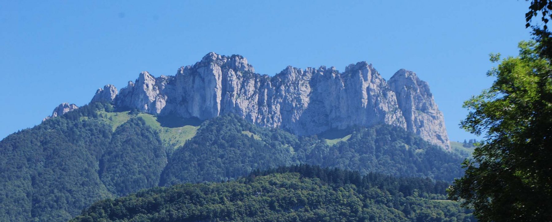
In the car park, you will see a large information panel on the reserve and its ecosystems. You will see that there are several routes. We recommend the belvedere circuit, marked in green. Very quickly, you will enter the woods. Make sure to follow the signs at the crossroads. The path will lead you to a remarkable viewpoint which offers a very beautiful panorama of the lake, the summit of La Tournette and the castle of Duingt. For the descent, follow the green circuit which crosses the undergrowth and leads you to the same parking lot along the Annecy golf course.
Level: Easy
Duration: 1h30
Departure: Roc de Chère car park (near the golf course)
Loop tour: yes
Good to know: The trails are well maintained and the markings are very clear.
Ecosystems to discover
This natural site has the distinction of housing five distinct areas, each with its microclimate: limestone slopes, a marshy valley, a central plateau, a central depression and ridges of sandstone. This variety explains why maple and boxwood coexist with rhododendrons in such a small area.